|
Jun. 2nd, 2019|12:32 pm |
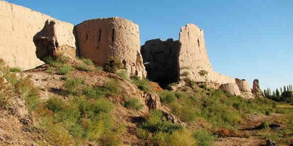
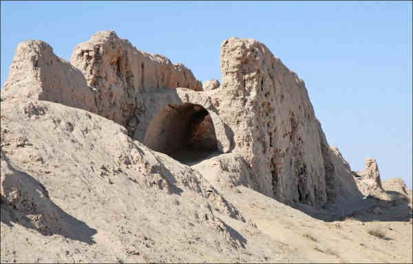
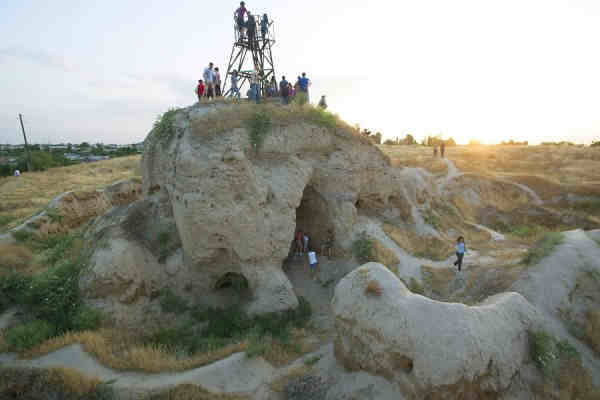
Uzbekistan has unique archaeological sites. However, information about them practically does not reach the general public. And if it reachs, it does not get the resonance that it deserves.
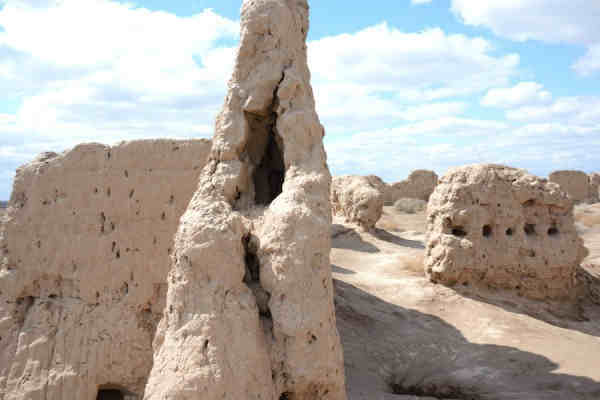
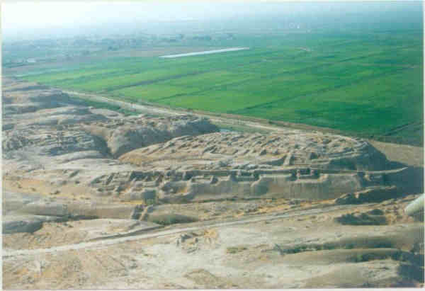
The count of ruins on the territory of Uzbekistan, perhaps, are more than in any other country in the world.
All this is not just saying, but shouting that a climatic catastrophe took place there. Local or global climatic catastrophe.
Узбекистан обладает уникальными археологическими памятниками. Однако информация о них практически не доходит до широкой публики. А если доходит, то совсем не получает того резонанса, который заслуживает.
Развалин на территории Узбекистана осталось, пожалуй, больше, чем в любой другой стране мира.
Все это не просто говорит, а кричит, что там имела место климатическая катастрофа. Локальная - или общемировая.
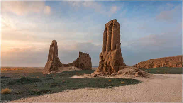
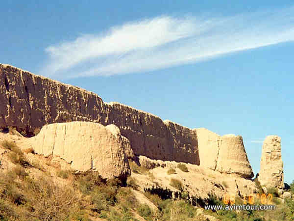
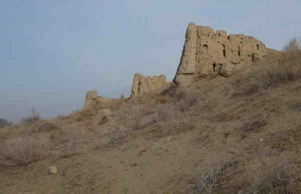
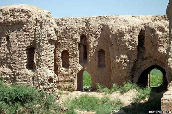
The remains of the fortress Dzhanpyk Kala / Остатки крепости Джанпык кала
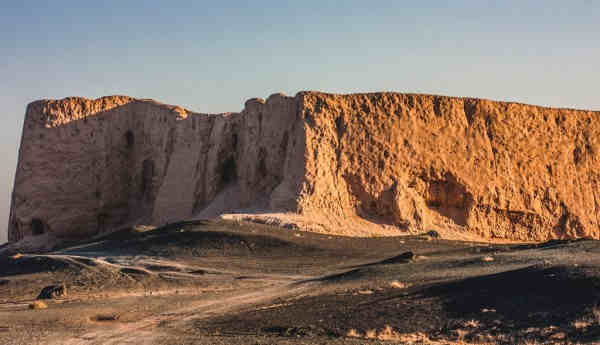
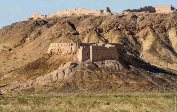
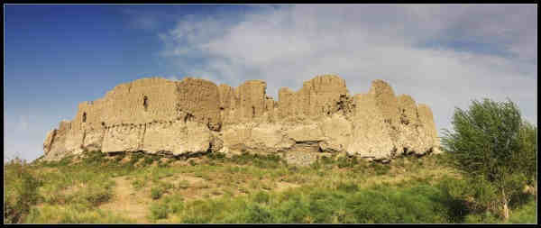
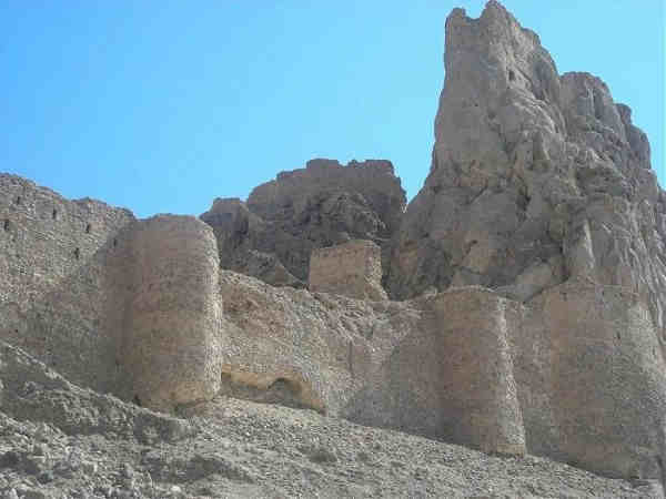
The remains of a huge fortress Chilpyk Kala / Остатки огромной крепости Чильпык кала
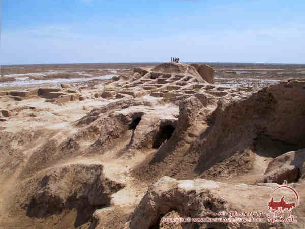
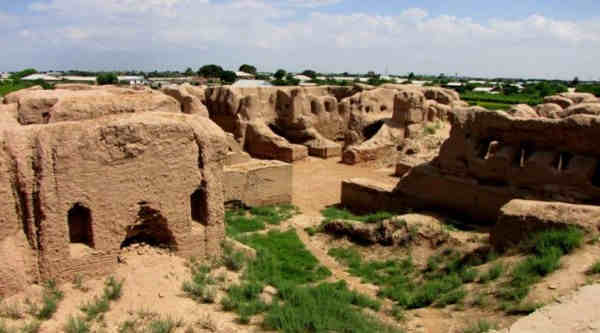
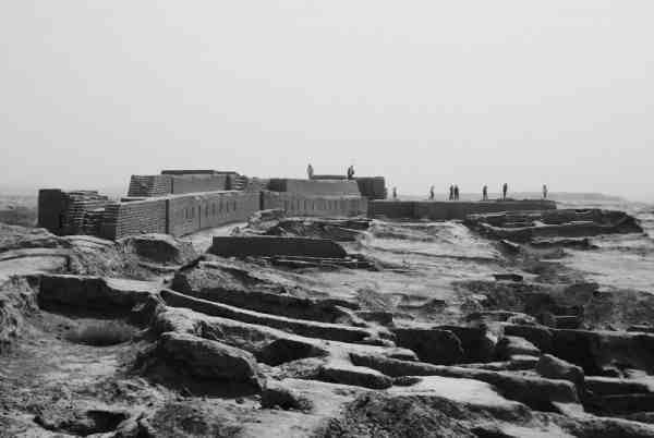
Toprak kala / Топрак кала
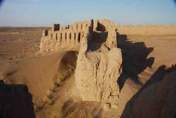
Ayaz Kala / Аяз кала
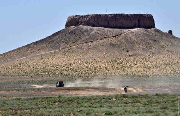
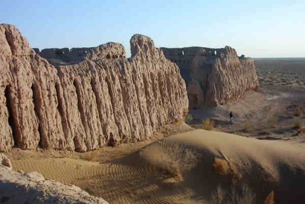
Kyzyl Kala / Кызыл кала
Kyrk Kyz Kala / Кырк Кыз кала

Janbas Kala / Джанбас Кала
Guildursun / Гильдурсун
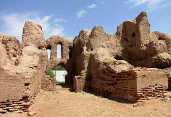
Pikend / Пайкенд
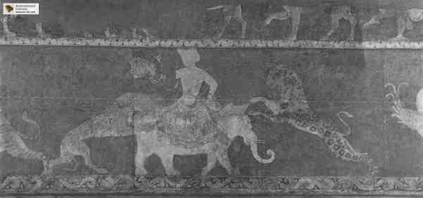
Varakhsha with its unique preserved frescoes / Варахша с ее уникальными сохранившимися фресками
It is the autonomous Republic of Karakalpakia and the Khorezm region / Это - автономная Республика Каракалпакия и Хорезмская область.
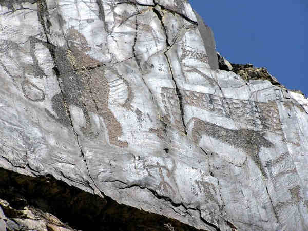
Sarmysh Sai gorge with neolithic paintings / Ущелье Сармыш Сай с неолитическими картинами
Kafir kala / Кафир кала
Kampyr Tepa / Кампыр тепа
Kyrk Kyz fortress near Termez / Крепость Кырк Кыз около Термеза
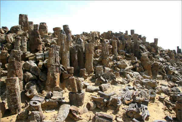
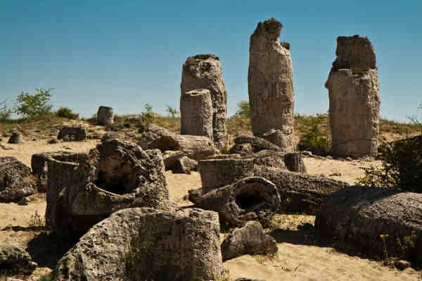
There is also a stone forest, Dzharakuduk in Uzbekistan / Есть еще каменный лес, Джаракудук на территории Узбекистана
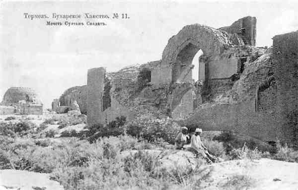
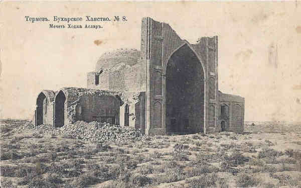
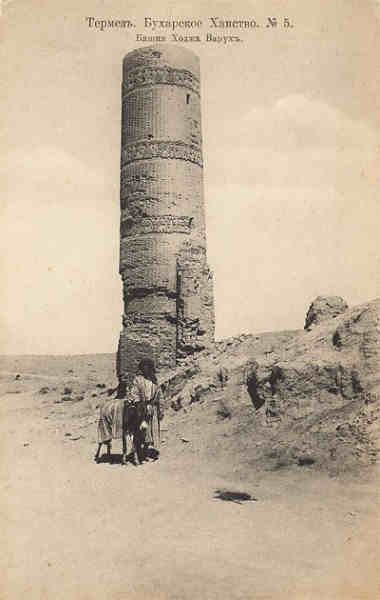
Photos of the ruins - a century ago / Фотографии развалин - столетней давности
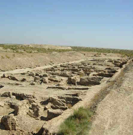
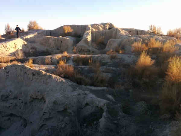
A large number of debris without systematization / Большое число развалин без систематизации
Uzbekistan is the northern part of the Pamirs / Ty'sh Shan - and the desert steppes are north of them. One and a half thousand absolutely flat steppes to the north - and the Urals and Siberia begin.
In the paradigm that official science is broadcasting to us - there is no place for these monuments. Indeed, in world history there are no climatic disasters. During the USSR, the existence of these monuments was not denied, but their descriptions and conclusions are something marginal.
Узбекистан - это северная часть Памира/ Тяшь Шаня - и степи пустыни за ними на север. Полторы тысячи абсолютно ровной степи на север - и начинается Урал и Сибирь.
В той парадигме, которую транслируют на нас официальная наука - этим памятникам нет места. Ведь в мировой истории - нет климатических катастроф. Во времена СССР существование этих памятников не отрицалось, но их описания и выводы - что-то маргинальное.
Source/источник:
https://radmirkilmatov.livejournal.com/181784.html
#asia #climatecatastrophe #climatechange #memory #metaprogramming #past #photo #property #revision #timespace #stan #uzbekistan #weather |
|